
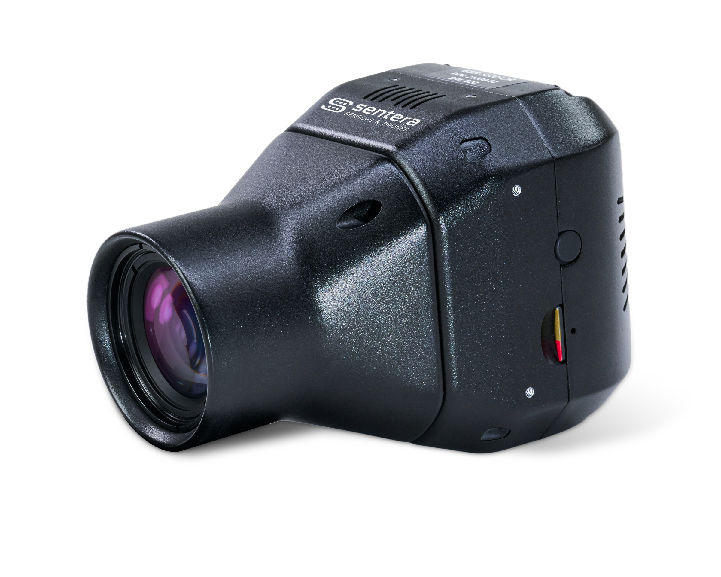

The Sentera 65R Sensor offers 65-megapixel global shutter RGB imagery optimized for drone operations. Its compact, lightweight design extends flight times, enhancing efficiency. With a resolution of 9344 x 7000 pixels, 3 FPS capture rate, lens variants, and live video, it ensures exceptional detail. The 65R, offers plug-and-play compatibility with popular drone platforms, making it ideal for surveying, mapping, inspection, and analytics. It empowers professionals to make informed decisions with high-resolution data, significantly reducing the number of images needed for comprehensive coverage.
The Sentera 65R Sensor offers 65-megapixel global shutter RGB imagery optimized for drone operations. Its compact, lightweight design extends flight times, enhancing efficiency. With a resolution of 9344 x 7000 pixels, 3 FPS capture rate, lens variants, and live video, it ensures exceptional detail.
The 65R, offers plug-and-play compatibility with popular drone platforms, making it ideal for surveying, mapping, inspection, and analytics. It empowers professionals to make informed decisions with high-resolution data, significantly reducing the number of images needed for comprehensive coverage.

Maximize Productivity
The global shutter, 3 FPS capture rate, real-time video, and gimbal stabilization enable quicker and longer flights without compromising data quality, meaning you can cover more ground significantly faster than any other camera on the market.
Maximize Productivity
The global shutter, 3 FPS capture rate, real-time video, and gimbal stabilization enable quicker and longer flights without compromising data quality, meaning you can cover more ground significantly faster than any other camera on the market.
Ease of Use
Plug-and-play integration on many popular UAS platforms, time-of-capture geo-tagging, and ample internal storage reduce training requirements and streamline workflows.
65R data is supported in most major image processing platforms which means the data ready for image processing immediately after flight.

High Accuracy
Equipped with 65 million pixels of global shutter image capture, integrated pulse-per-second (PPS) synchronization, and time-of-capture geo-tagging, the 65R ensures high-accuracy data right out of the box
High Accuracy
Equipped with 65 million pixels of global shutter image capture, integrated pulse-per-second (PPS) synchronization, and time-of-capture geo-tagging, the 65R ensures high-accuracy data right out of the box
Live Video
Monitor real-time footage, ensuring optimal positioning to capture critical moments. This feature enhances situational awareness, enables instant decision-making, and facilitates adjustments mid-flight, leading to more precise and comprehensive data collection.

Live Video
Monitor real-time footage, ensuring optimal positioning to capture critical moments. This feature enhances situational awareness, enables instant decision-making, and facilitates adjustments mid-flight, leading to more precise and comprehensive data collection.

Exceptional Color Quality
Large sensor size and high-quality lens system capture rich details and accurate colors, ensuring controlled color quality without creative or artistic modes.
Exceptional Color Quality
Large sensor size and high-quality lens system capture rich details and accurate colors, ensuring controlled color quality without creative or artistic modes.


Cutting-Edge Imaging for Mapping and Modeling
Ideal for large-scale surveying and monitoring, the Sentera 65R sensor reduces flight time while maintaining superior image quality, optimizing mission efficiency.
- 65MP global shutter sensor eliminates motion blur for clear, sharp image
- Fast capture rate enhances productivity, minimizing flight time per project
- NDAA Compliant
- Open and standardized data formats
MAPPING
MAPPING
FORESTRY
AGRICULTURE
INSPECTION
WEED PRESSURE
CONSTRUCTION
- GSD @200ft (60m): 0.28in (0.7cm)
- GSD @400ft (120m): 0.55in (1.4cm)
- Field of View: 58° HFOV
- GSD @200ft (60m): .12in (0.3cm)
- GSD @400ft (120m): 0.25in (0.6cm)
- Field of View: 27° HFOV
(63.5mm x 70.6mm x 106.4mm)
- Skyport: 580g
- Smart Dovetail: 588g
- Gremsy Hyper Quick: 564g
- USB-C
- Gigabit Ethernet
- UART
- Digital I/O
Input Pulse/PWM for Image Capture
Input Pulse Per Second (PPS) for Time/Position - Sync
Output Pulse for Image Exposure Sync
- Integrated IMU
- Pushbutton Trigger Option
- DJI M300/M350
- Freefly Astro
- Freefly Alta X Gen2
- Inspired Flight IF800
- Inspired Flight IF1200
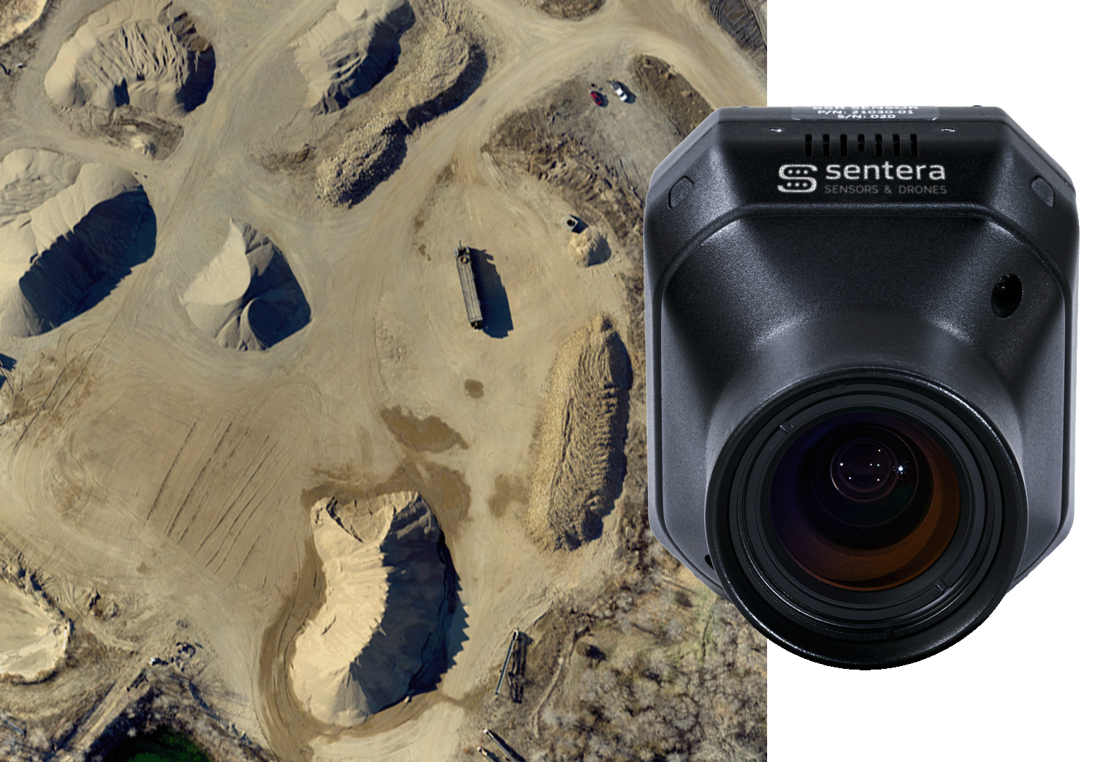

Sentera 65R
Cutting-Edge Imaging for Mapping and Modeling
Ideal for large-scale surveying and monitoring, the Sentera 65R sensor reduces flight time while maintaining superior image quality, optimizing mission efficiency.
- 65MP global shutter sensor eliminates motion blur for clear, sharp image
- Fast capture rate enhances productivity, minimizing flight time per project
- NDAA Compliant
- Open and standardized data formats
Surveying
Mapping
Forestry
Agriculture
Inspection
Construction
- GSD @200ft (60m): 0.28in (0.7cm)
- GSD @400ft (120m): 0.55in (1.4cm)
- Field of View: 58° HFOV
- GSD @200ft (60m): .12in (0.3cm)
- GSD @400ft (120m): 0.25in (0.6cm)
- Field of View: 27° HFOV
(63.5mm x 70.6mm x 106.4mm)
- Skyport: 580g
- Smart Dovetail: 588g
- Gremsy Hyper Quick: 564g
- USB-C
- Gigabit Ethernet
- UART
- Digital I/O
Input Pulse/PWM for Image Capture
Input Pulse Per Second (PPS) for Time/Position - Sync
Output Pulse for Image Exposure Sync
- Integrated IMU
- Pushbutton Trigger Option
- DJI M300/M350
- Freefly Astro
- Freefly Alta X Gen2
- Inspired Flight IF800
- Inspired Flight IF1200
High Res, High Speed, High Impact
The Advantages of a Global Shutter
High Res, High Speed, High Impact
The Advantages of a Global Shutter
No Mechanical Wear, No Failures
Unlike mechanical shutters, which degrade over time, the 65R’s global shutter has no moving parts, ensuring consistent performance and a longer lifespan for UAV-based imaging.

No Mechanical Wear, No Failures
Unlike mechanical shutters, which degrade over time, the 65R’s global shutter has no moving parts, ensuring consistent performance and a longer lifespan for UAV-based imaging.

Distortion-Free Imagery at Any Speed
Rolling shutters introduce motion artifacts in high-speed flight, distorting linear features like power lines and roads. The 65R’sglobal shutter captures every pixel simultaneously, eliminating skew and ensuring precise geospatial accuracy.
Distortion-Free Imagery at Any Speed
Rolling shutters introduce motion artifacts in high-speed flight, distorting linear features like power lines and roads. The 65R’sglobal shutter captures every pixel simultaneously, eliminating skew and ensuring precise geospatial accuracy.
Optimized for High-Frequency Data Collection
Designed for thousands of captures per flight, the 65R excels in high-speed, high-volume applications like surveying, infrastructure inspection, and precision mapping—without risk of shutter degradation.

Optimized for High-Frequency Data Collection
Designed for thousands of captures per flight, the 65R excels in high-speed, high-volume applications like surveying, infrastructure inspection, and precision mapping—without risk of shutter degradation.

Why It Matters
- No shutter wear: Reliable, long-term operation
- Distortion-free imaging: No motion blur or skew
- Fast, precise data capture: Ideal for UAV-based mapping & inspection
With the 65R, operators get uncompromised image clarity, reliability, and efficiency, making it the ideal choice for high-performance aerial imaging.
Lens Options


The 65R utilizes custom designed lens to provide a high-quality optical path. Offered in two focal lengths, 27mm (58-degree HFOV) and 60mm (27-degree HFOV).

This diagram illustrates the difference in field of view (FOV) and ground sampling distance (GSD) between the 27mm and 60mm lens options. The 27mm lens, with its wider FOV, is ideal for large-area mapping and broad coverage applications, reducing the number of images needed per flight. The 60mm lens, with its narrower FOV and finer GSD, is best suited for high-detail imaging in infrastructure inspections, surveying, and precision measurements where accuracy at a distance is critical.

See How ALDOT Uses The 65R Sensor to Bring Airport Pavement Into Focus.
Aging pavement is one of the biggest challenges facing small regional airports. Agencies like ALDOT need a full view of runway conditions without shutting down operations or relying on partial inspections. These airports often operate with limited staff and tight scheduling windows, so minimizing disruption is essential.

Curious about how the Sentera 65R sensor enables precision weed detection?
See how researchers at North Dakota State University used the Sentera 65R sensor to map weeds in sugar beet fields with pinpoint precision. Discover how high-resolution imagery enabled targeted tillage, reducing fuel use, preserving soil health, and improving operational efficiency.
Compatible with Industry-leading Gimbal Interfaces

DJI Skyport

Gremsy Hyper Quick HDMI V1

Smart Dovetail
DJI Skyport
Gremsy Hyper Quick HDMI V1
Smart Dovetail
Purpose-built for seamless Drone integration
The 65R gimbal is designed and manufactured by Sentera and is offered in several different interface options to allow the sensor to be mounted on nearly any drone as a turn-key solution or integrated as desired.
Download sample datasets for the 65R Sensor
Baseball Field
BASEBALL FIELD -200FT
Flight Specifications:
- Aircraft: Freefly Astro
- GSD:
0.28in / 0.72cm - Altitude: 200ft / 60m
- Overlap: 80%
- RTK: No
BASEBALL FIELD – 400FT
Flight Specifications:
- Aircraft: IF1200
- GSD:
0.57in / 1.44cm - Altitude: 400ft / 120m
- Overlap: 80%
- RTK: No
Corn Fields
CORN FIELD – 200FT
Flight Specifications:
- Aircraft: IF800
- GSD:
0.28in / 0.72cm - Altitude: 200ft / 60m
- Overlap: 75%
- RTK: No
CORN FIELD 2 – 200FT
Flight Specifications:
- Aircraft: IF800
- GSD:
0.28in / 0.72cm - Altitude: 200ft/60m
- Overlap: 75%
- RTK: No
CORN FIELD – FIXED WING
Flight Specifications:
- Aircraft: Sentera PHX
- GSD:
0.28in / 0.72cm - Altitude: 200ft/60m
- Overlap: 70%
- RTK: No
Gravel Piles
RINGO LAKE – FIXED WING
Flight Specifications:
- Aircraft: Freefly Astro
- GSD:
0.57in / 1.44cm - Altitude: 400ft / 120m
- Overlap: 80%
- RTK: No
EAGLE LAKE – FIXED WING
Flight Specifications:
- Aircraft: Sentera PHX
- GSD:
0.57in / 1.44cm - Altitude: 400ft/120m
- Overlap: 80%
- RTK: No
65R vs P1 vs A7R4 Comparison
A comparison of datasets using the same target (a field containing late-stage production corn) allowing comparison between the DJI P1, Sentera 65R, and Sony A7R4 sensors. Two options are available below, flights using constant altitude and flights using constant ground sample distance. Learn more by selecting the options below.
Unlock New Insights with Sentera Sensors
Reach out today to explore how our cutting-edge sensors and drones can revolutionize your operations.
